Cedar & Sand

Human-Powered Adventures in the West

New Harmony

Friday, June 13, 2014 By TK421 3 Comments
We lived in the peaceful little hamlet of New Harmony this past year. While I wont miss the 1/2 hour commute to Cedar City everyday, I will miss the incredible Kolob sunsets and quick access to the northern part of Zion National Park.

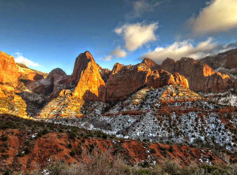
The sun sets on the Kolob Fingers of Zion National Park.  This is right from the back porch.


The Middle and south Forks of Zion's Taylor Creek is one our favorite hikes with the kids.


The Kolob Scenic Drive. Just minutes off of I-15.


Gustive Larson completed his cabin in 1931 near the confluence of the North and Middle Forks of Taylor Creek. But by 1937, the government claimed the entire area (including Gustive's homestead) part of the Kolob National Monument. The area was incorporated into Zion National Park in 1956.


The trails in LaVerkin Creek and Hop Valley became my favorite running routes while living in New Harmony. It's only a 15-minute drive to the Lee Pass trailhead.

Delightful Hop Valley singletrack.


Cool stream crossings keep things lively in Zion's Hop Valley.


LaVerkin Creek morning.

A rare heavy snow-fall blankets the Red Reef and Orson Adams house at Harrisburg -- about 20 miles south of New Harmony.

Share:

TK421
TK421

Related Articles


3 comments:

Kwei said...

Great photos with magical light.

October 5, 2014 at 4:19 PM
Gordon Smith said...

All photos are wonderful here. This is a place I need to get to for a sunset photo.

May 5, 2018 at 7:37 AM
Goldie said...

Great pictures! Going to explore this are soon!

April 24, 2020 at 4:23 PM

Post a Comment

Newer Post Older Post Home
Subscribe to: Post Comments ( Atom )

Popular Posts

  • Greater Canyonlands: Blue John & Horseshoe Canyons
    This is day one of my three-day adventure into the Horseshoe Canyon-Maze area of Canyonlands. The trip didn't start out too great. It ...
  • Shorty's to Telescope Peak, Death Valley N.P.
    Death Valley is well known as having the lowest point in North America in Badwater Basin at nearly 300 feet below sea level. Much less well...
  • Found!! The Red Man Pictograph of Timpie Valley
    I've seen only obscure references to the Timpie Valley "Red Man" pictograph. All I could surmise from a couple of pictures was...
  • The Tushars, Crushed
    A quick report from a marathon excursion into Utah's Tushar Mountains last July (2017). At over 12,000 feet, the Tushars are the h...
  • White Pocket Confounds
    The Wave....on crack....a.k.a. White Pocket. The wonders of White Pocket on the Paria Plateau just south of the Utah border remain s...
  • Found!! The Naming Cave
    I've had a good luck streak these last couple of months. I've finally found a few things that have been driving me crazy for years. ...

Labels

  • ashdown gorge
  • backpacking
  • canyoneering
  • Deep Creek Range
  • Gold Butte
  • henry mountains
  • hikes with kids
  • La Sal Mountains
  • little death hollow
  • moab
  • Mojave Desert
  • peak bagging
  • Zion National Park

About Me

TK421
View my complete profile

Subscribe To Cedar & Sand

Posts
Atom
Posts
Comments
Atom
Comments

Blog Archive

© 2016 Cedar & Sand | All rights reserved
Created By Responsive Blogger Templates | Distributed By Blogger Templates20