Cedar & Sand

Human-Powered Adventures in the West

Cathedral Valley, Capitol Reef National Park

Thursday, June 23, 2011 By TK421 3 Comments
We finally made it out to Cathedral Valley over Memorial Day weekend. I've spent a lot of time in the central part of Capitol Reef National Park, and I've been trying to get to the more remote, but no less interesting northern and southern parts of the park for some time. The Water Pocket Fold district will be next.

By the time we rolled into the primitive Cathedral Valley Campground (only six sites) Saturday night, it was full. It was no big deal, we just drove a couple more miles up the road toward Thousand Lake Mountain and into the Dixie National Forest where dispersed camping allowed.

Here are the photos in no particular order:


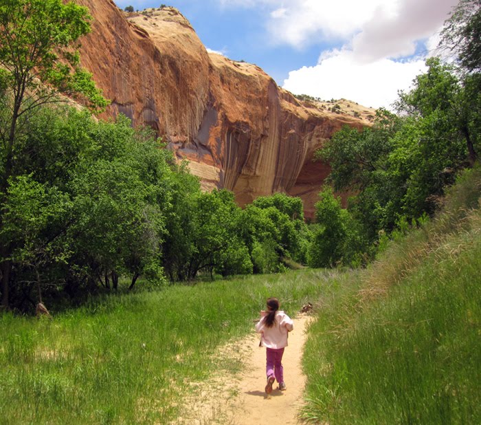
On the way home, we stopped to hike the Lower Calf Creek Falls trail. It's a good six miles round trip, but the girls had no problem with the distance.


Share:

TK421

Related Articles


3 comments:

Matt Anderson said...

Awesome pictures. The South Desert Overlook (the one with your daughters) is one of my favorite places I have ever been to! I guess I am a desert rat!

July 1, 2011 at 12:04 AM
Anonymous said...

The scenery is magnificant, but there is also talent behind the camera. And daughters mighty cute!

Bill Gordon

July 3, 2011 at 7:43 PM
Anonymous said...

Careful; Zo and the Ave-ster are so cute people will miss the background scenery.
-Matt

July 7, 2011 at 11:08 AM

Post a Comment

Newer Post Older Post Home
Subscribe to: Post Comments ( Atom )

Popular Posts

  • Greater Canyonlands: Blue John & Horseshoe Canyons
    This is day one of my three-day adventure into the Horseshoe Canyon-Maze area of Canyonlands. The trip didn't start out too great. It ...
  • Shorty's to Telescope Peak, Death Valley N.P.
    Death Valley is well known as having the lowest point in North America in Badwater Basin at nearly 300 feet below sea level. Much less well...
  • Found!! The Red Man Pictograph of Timpie Valley
    I've seen only obscure references to the Timpie Valley "Red Man" pictograph. All I could surmise from a couple of pictures was...
  • The Tushars, Crushed
    A quick report from a marathon excursion into Utah's Tushar Mountains last July (2017). At over 12,000 feet, the Tushars are the h...
  • White Pocket Confounds
    The Wave....on crack....a.k.a. White Pocket. The wonders of White Pocket on the Paria Plateau just south of the Utah border remain s...
  • Found!! The Naming Cave
    I've had a good luck streak these last couple of months. I've finally found a few things that have been driving me crazy for years. ...

Labels

  • ashdown gorge
  • backpacking
  • canyoneering
  • Deep Creek Range
  • Gold Butte
  • henry mountains
  • hikes with kids
  • La Sal Mountains
  • little death hollow
  • moab
  • Mojave Desert
  • peak bagging
  • Zion National Park

About Me

TK421
View my complete profile

Subscribe To Cedar & Sand

Posts
Atom
Posts
Comments
Atom
Comments

Blog Archive

© 2016 Cedar & Sand | All rights reserved
Created By Responsive Blogger Templates | Distributed By Blogger Templates20